Tapaliza Fm
Type Locality and Naming
- Schuchert (1935). Dark foraminiferal shales. Tapaliza is the name of a village on tributary of Río Pucro.
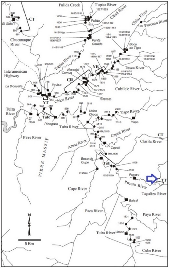
- The Tapaliza Fm was named for the Tapaliza River, a tributary of the Tuira River in the north of Darién around the Membrillo River (Esso Exploration and Production Panama (1970)) (Figure 144).
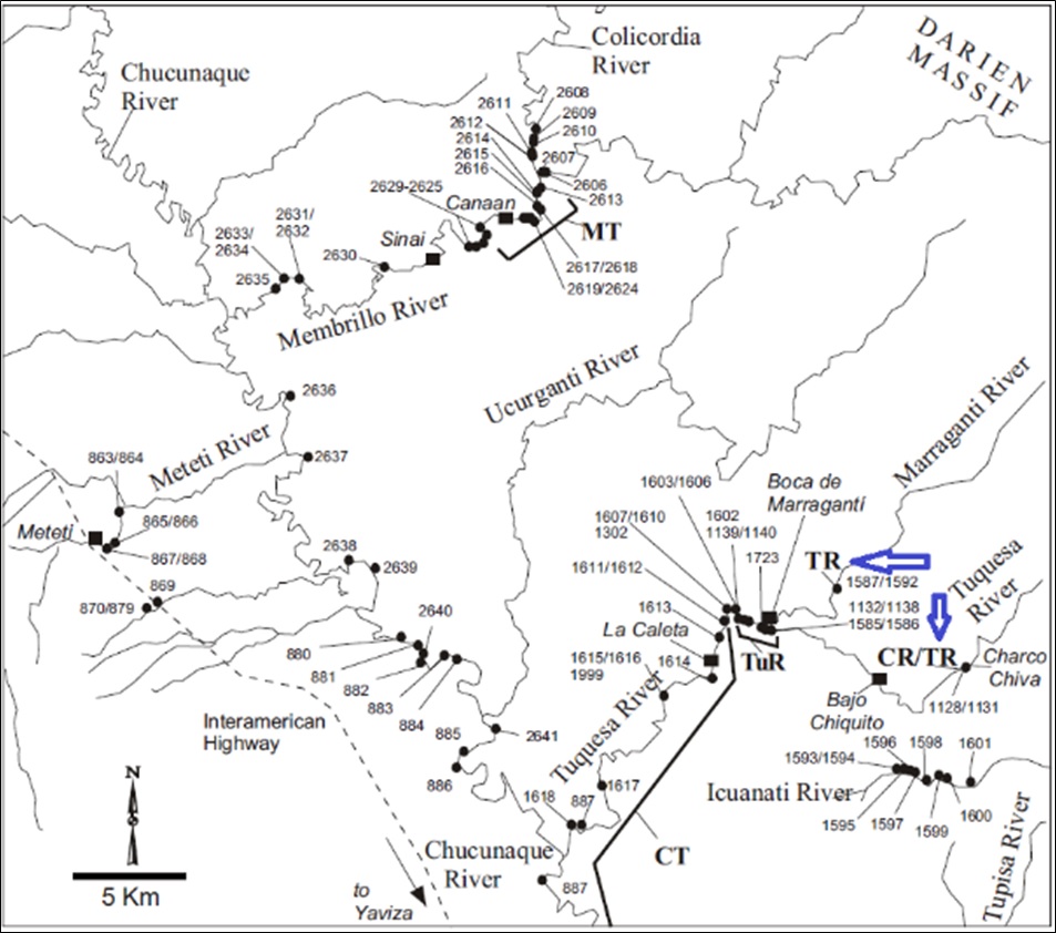
- The stratotype (TT) is located as shown on Figure 144 and runs for about 4 km above the confluence with the Pucuro River. Reference sections (TR on Figure 145) lie along the Tuquesa River at Charco Chiva and along the Marraganti River, about 10 km above its junction with the Tuquesa River. Coates et al. (2004)
[Figure 144. Locality of the Tapaliza Fm stratotype. Coates et al. (2004).]
[Figure 145. Locality of the Tapaliza Fm Reference Section. Coates et al. (2004).]
Synonym: Topaliza Fm (In some publications it is wrongly spelled “Topaliza”)
Lithology and Thickness
In the north, around the Membrillo River, the Tapaliza Fm is dominantly conchoidally weathering foraminiferal mudstone and siltstone containing abundant mollusk-rich horizons, and minor 10-20 cm thick volcanic sandstone units, often with prominent calcareous 5-10 cm concretions. Occasional cobble horizons also occur.
Farther south, between the Tapaliza and Chico Rivers, the formation consists dominantly of thin, evenly bedded, coarse volcanic sandstone alternating with burrowed black shale. The base of the sandstone units is generally characterized by abundant flame structures and load casts. In the lower half of the sequence the sandstone is laminated, with low-angled cross-bedding, abundant carbonaceous material with frequent entire leaves, and concretions up to 1.5 m in diameter at some horizons. Interbedded sublenticularly laminated clayey siltstone contains channel lenses with shell hash and Pectén shell beds.
On the western flank of the Tuira Basin, around Yaviza, the Tapaliza Fm shows a different facies. Five to 10 cm thick rhythmically bedded turbidite units consist of alternating graded graywacke and blackish gray clayey siltstone. The siltstone units are rich in pteropods, foraminifera (especially Orbulina), and finely disseminated plant fragments.
The Río Tapaliza exposes dominant mudslides with concoidal weathering, fossiliferous and limolites, containing sections with abundant mollusks and less abundant volcanic sandstone, forming strata 10 to 20 cm thick. These strata often contain calcareous concretions 5-10 cm in diameter. Further south between the Río Tapaliza and the Río Chico, thin layers of coarse sandstone alternate with black shales with small cavities. In the lower part of the sequence the sandstone is laminated, with cross stratification, abundant carbonaceous material, and frequent whole leaves. The inter-stratification exposes thin layers of clayey silt and Pecten shells. On the west flank of the Tuira Basin, the formation exposes a different facies, turbidites with rhythmic stratification of 5 to 10 cm in width, in graded graywacke alternating with blackish gray clayey siltstones. Limolites rich in pteropods (mollusks), foraminifera (Orbulin), and fine dissemination of plant fragments. Coates et al. (2004).
Thickness: The thickness of the Tapaliza Fm ranges from about 400m in the northwest to 1200m near Yaviza.
Relationships and Distribution
Lower contact
Upper contact
Regional extent
GeoJSON
Fossils
Age
Depositional setting
Additional Information
- Schuchert (1935).
- Olsson (1942b). Tapaliza Gr includes Arusa Fm and Aguagua Fm. Chart shows Tapaliza Fm above Capetí limestone Fm and below Gatún Fm. Upper Oligocene and lower Miocene.
- Wilson et al. (1957)
- Woodring (1960); An undefined name of formation or group rank to include the Arusa and Aquaqua Members or Formations. Though used later by Sapper (1937, p. 451) and Olsson (1942b, pp. 234, 241), the name still is undefined.
- Keroher (1966); Esso Exploration and Production Panama (1970)
- Coates et al. (2004); Montes et al. (2010);

